By, Ryan Carda ![]()
Soil identification can serve as one of the largest obstacles to generating an accurate horizontal loop design. That’s because it plays a large part in determining how many trenches are needed and how long they need to be. While it may sound simple, soil identification isn’t an area that most people are formally trained in.
Soil Properties
To design a horizontally-trenched loopfield, the important soil properties - thermal conductivity and thermal diffusivity - need to be quantified. These properties are dependent on three primary factors:
- Soil type
- Moisture content
- Density
As described in this article, it is generally best to be conservative and assume that both density and moisture content are average to below average, unless you have enough information to justify a different assumption. Beyond that, soil type is the only factor left to define, which is where your homework begins.
Possible Resources
There are a number of resources to help determine soil type at the job site. County soil maps, soil survey reports and geotechnical reports may serve as a decent starting point in your search. Local excavation contractors that provide services such as septic tank installation may be able to provide firsthand knowledge of the soil type in an area as well.
Possibly the best, most accessible source of information is the USDA’s Web Soil Survey (WSS).
Using Web Soil Survey
WSS is a free online service that provides access to soil data collected by the National Cooperative Soil Survey, and is very easy to use. Soil identification is done in three simple steps:
- Enter the project location. WSS accepts many different forms of input for location - address, latitude and longitude, Public Land Survey System (PLSS) coordinates, etc.
- With the correct location shown on the map, simply zoom to the area where the loopfield is to be located and draw a box to create an Area of Interest (AOI).
- View soil type(s) in the AOI.
Once the AOI has been successfully created, WSS provides a free pdf download of the soil report, which includes:
- Soil map with legend
- Detailed description of the soil types along with the occurrence level for each (expressed as a percentage)
To download the report, simply click on the “Shopping Cart” tab, name the report, choose the options in Table of Contents, and click Check Out to begin the download process.
Try an Example
For example, our office is located at 302 E. Warehouse St., Elkton, SD 57026. Enter this in the search box, zoom in to create an AOI as shown:
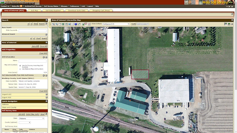
Once the AOI has been defined, the ‘Soil Map’ link will show a detailed map of the soil types in the area. For this example, the predominant soil type in the area is Silty Clay Loam (Z181A - Brandt)
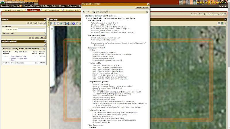
Click here to download the sample report for this example.
Soil Identification in LoopLink RLC
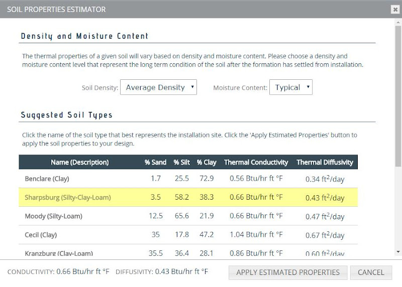
Once you have identified the soil type in your area, assigning soil properties in LoopLink RLC is relatively easy:
- Assign soil density level (low, average, high)
- Assign soil moisture content (dry, typical, wet)
- Find a similar soil type in the Soil Estimator
In general, leave the selection for moisture content and density level at the default settings unless better information is available (i.e. a geotechnical report is available and provides enough detail to justify a change). From there, simply choose the soil type that most closely matches the soil identified in WSS. When making your choice, focus on the description in the table (clay, silty-loam, etc.).
Once you’ve made your selection, LoopLink RLC will provide recommendations for soil thermal conductivity and thermal diffusivity and you can proceed with the horizontally-trenched loop design.
Although soil identification can be intimidating (especially to the new designer), it is vital to accurate loop design. USDA’s Web Soil Survey breaks down this barrier. The service is easy to use and best of all, it’s free!